Leeds / Bradford International Airport Spotting Locations (EGNM) and Guide's
Leeds / Bradford is a Typical UK Regional Airport mainly filled with UK Low cost airlines, with airlines basing certain aircraft at the airport. Nowadays, Leeds have also got Daily Asian services such as PIA. Leeds also get other charter airlines during the week but is mainly for low cost airlines such as jet2 Holidays. Leeds Bradford also have good Bizjet movements during the day and week offering some great shots of Private and turboprop Aircraft. Leeds only have the 1 Runway which is Runway 14/33 depending on the direction of the wind.
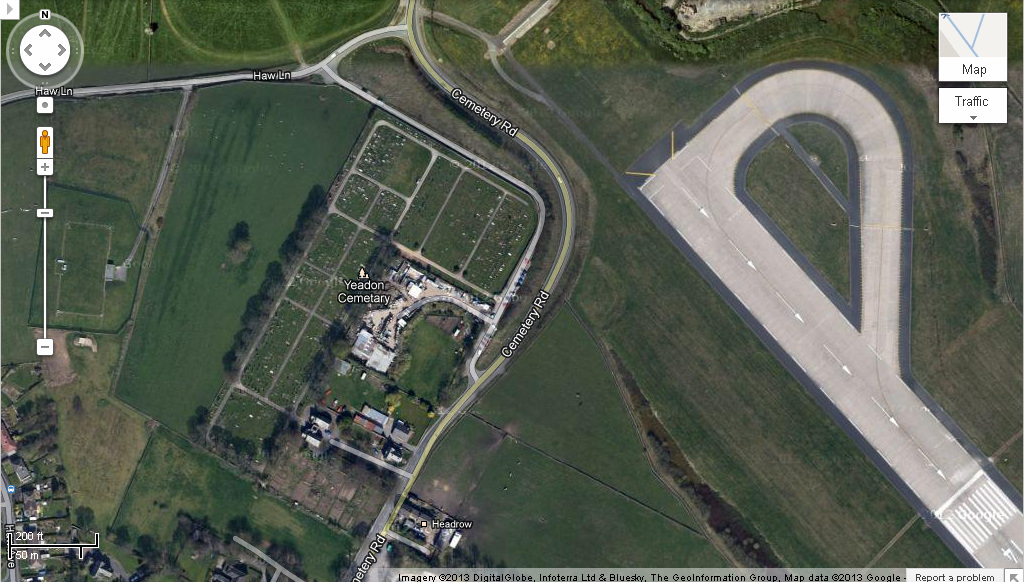
Yeadon CemeteryThe Cemetery offers some good shots from the end of runway 14 and when aircraft depart on runway 14 they have to backtrack to line up offering great head on shots, but due to Trees, bushes and plants in they way it may be harder to get shots, however there is a wall that can be stood on but be careful when doing so.
To get to Yeadon Cemetery, the following co-ordinates should help (These may not be exact) Latitude: N53º 52' 22" (N52º.52.367') Longitude: W1º 40' 26" (W1º.40.465') __________________________________________________________________ |
|
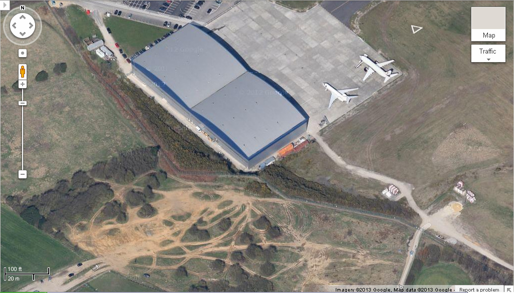
Dirt TrackThe dirt track overlooks the runway and offers some great shots, although it should be avoided in the wet as you can probably tell by the name. It is great for Rotation shots taken near the bushes. This spot is good for afternoon shots.
To Get to the Dirt track, the following co-ordinates should help (These may bot be exact) Latitude: N53º 51' 46" (N53º.51.77') Longitude: W1º 40' 4" (W1º.40.818') __________________________________________________________________ |
|
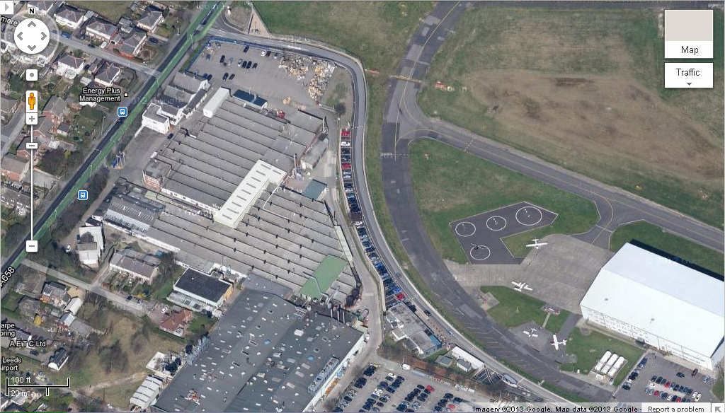
Multiflight Flying SchoolThe flying school is great for photo's but a longer lens is needed and if you want to take registrations, binoculars will be needed as it is a long way from the fence.
To get to the Flying School, the following co-ordinates should help (These may not be exact) Latitude: N53º 51' 59" (N53º.51.988') Longitude: W1º 40' 4" (W1º.40.061) |
|
